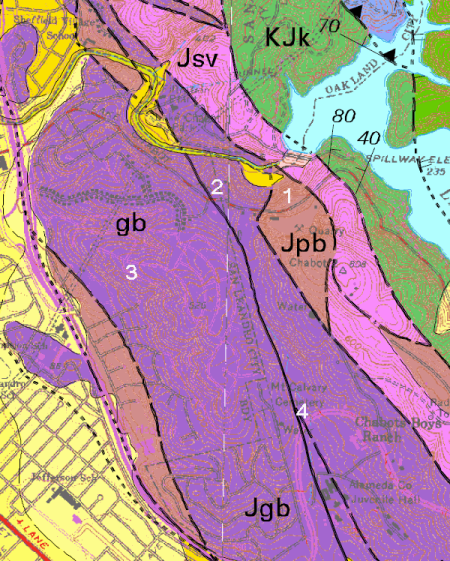
San Leandro is a much smaller city than Oakland, but it has its share of interesting rocks and features. ‘Twas a cloudy day when I visited, but the worst day geologizing is better than the best day working. Here’s the geologic map with the photo locations numbered on it.
The purple area marked Jgb is underlain by the San Leandro Gabbro, of Jurassic age, a crystalline rock similar to granite that belongs to the Coast Range Ophiolite. It’s about 160 million years old and was once a deep-seated part of the oceanic crust. Unfortunately the color, while it follows the official U.S. government geologic color guidelines for Mesozoic plutonic rocks, makes the map hard to read. The blob of brown marked Jpb represents Jurassic pillow basalt, which I thought would be very interesting to see. And the solid black line down the middle of the map is the Hayward fault — it’s solid black because the fault is very well mapped there.
The San Leandro Rock Quarry has been closed for a few years.
The land is for sale — 58 acres of it, right on the Hayward fault — but I didn’t feel up to impersonating a possible buyer, so it was off limits. But the view the other way is pretty cool, overlooking the gorge of San Leandro Creek below the Chabot Reservoir dam. It’s the biggest canyon between Niles Canyon and Wildcat Canyon and pretty intimidating.
A little ways west on Lake Chabot Road, where it meets Astor Drive, is a saddle in the hillside where the Hayward fault crosses the road. A steep gulch descends to the north along the fault trace. To the south, the Bay-O-Vista Swim and Tennis Club has nestled on the fault unscathed for almost 60 years.
We’ll visit the fault on the other side of the club. But first, the gabbro! It’s exposed in various places in the Bay-o-Vista neighborhood, where it’s mostly shattered from being next to the fault for millions of years.
Gabbro is made up mostly of dark pyroxene and light plagioclase feldspar. Like granite, it likes to weather into decent soil. The excavations of residential areas are helpful in bringing it into view. And up close, this gabbro is pretty.
Studies of this area using airborne gravity meters and magnetic instruments suggest that this gabbro extends well north and south of here in a big slab about 3 kilometers thick lying between the Hayward and Chabot faults, tilted almost straight up and down. This figure is from a 2003 study led by Dave Ponce of the U.S. Geological Survey.
In Oakland, the gabbro shows up in stringers and blobs along the fault as far north as Chimes Creek. I’ve picked up pieces on Eastmont hill by the reservoir. But the geophysical study suggests that it underlies a much larger area as far as Merritt College, beneath the surface rocks.
The gabbro is strong enough that it bends the Hayward fault slightly off course. But during the 1997-98 El Niño, a big hunk of hillside gave way just below the place where I shot the outcrop. Two homes were lost.
The top of the slide displays some pretty rotten stone.
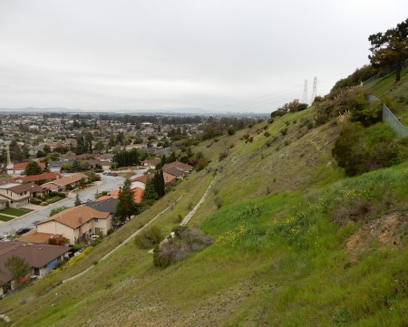
Farther south, Fairmont Road swings around the county juvenile justice center past the Hayward fault. This is looking north from there up the fault trace.
Our active faults grind up the rocks so fine that they’re easily eroded into gulches, gullies and valleys, and that’s what this one is. It last ruptured on October 21, 1868, so any trace of that is long gone. It takes careful trenching studies to find it. We’ll have to wait until the next big one to see where it decides to rip up the ground.


Leave a reply